...strategic points, flexible lines, tense surfaces,
political volumes
|
Ariel Sharon and the Geometry of
Occupation:
strategic points, flexible lines, tense
surfaces, political volumes
Part one: Border versus frontier
The
post-1967 transformation of the occupied territories is
the story of how Israeli military and civilian planning
became the executive arm of geopolitical strategy. The
Suez Canal battles of the Yom Kippur war in 1973 were a
national trauma that returned the frontier to the
Israeli public imagination. The figure of Ariel Sharon
is central to this process.
Part
two: Architecture as war by other means
How does
Ariel Sharon imagine territory and practice space? The
settlements, the battle for the hilltops, and now the
security fence embody his long-term territorial
ambition: to combine control of the West Bank with
physical separation of its populations.
Part three: Temporary permanence
The
barrier exemplifies the dystopian logic of Israeli
occupation of the West Bank, where a fragmented,
borderless, always-provisional territory refuses
accommodation with security ambitions that seek
definitiveness. There is no spatial-technical design
solution to the conflict: it can only be
political.
will be published on 15 September
2003
|
Part one: Border versus frontier
The wording of the current Middle East peace initiative,
the roadmap, has managed perhaps unwittingly
but clearly all the same to equate the transformation of the
built environment with acts of organised violence. The action
required from the Palestinians on a way to a final and
comprehensive settlement of the IsraeliPalestinian conflict
by 2005 is to undertake an unconditional cessation of
violence, and dismantle the infrastructure of terror; while
Israel must (freeze) all settlement activity and
immediately (dismantle) settlement outposts
.
Israel is to stop planning, constructing and populating
then dismantle the settlements built by independent groups
in breach of its own laws. The Palestinian authority is to
prevent shooting, shelling and suicide attacks carried out by
armed organisations, dismantle their infrastructures and
arrest their masterminds. Although the document does not make
it clear if it sees the activities of each side as comparable
(or merely trapped in a cyclical sequence of causes and
effects), never before was the work of architects and planners
so clearly corroborated with those of terrorists.
Indeed, the human and political rights of Palestinians are
violated not only by the frequent blows of the Israeli
military, but by a much slower and steadier process in which
the totality of the environment in which they live is
configured around them as an ever-tightening knot.
 |
 |
|
This essay
extends and connects with the general thesis set out in
my 2002 openDemocracy project, The Politics of
Verticality. It examines the process by which, after
the expansion of Israels borders following the 1967
war, these borders have been dissolved and transformed:
from being fixed fortified lines, laid out at the edges
of the occupied territories, to fragmented and scattered
inner frontiers across both horizontal and vertical
dimensions. |
|
|
|
 |
In this process, the transformation of the territories
occupied by Israel since 1967 became a parallel conflict,
carried out with pencil lines on the drafting tables of
military and civilian planners and architects. The West Bank
as we know it today has come to be, not as a result of a
collection of accumulated haphazard decisions of incremental
politics, but as the spatial outcome of a strategic planning.
The design and construction of the security barrier
through and around the West Bank is to complete the last stage
in the Israeli project of territorial control.
It may appear that with the construction of such a
border-like apparatus, Israel has finally surrendered to
military contingencies and political pressures, thus
transforming its entrenched territorial policies (how else
could Ariel Sharon, the person who epitomises Israels
settlement project, be the one finally to set a border through
the heart of the land of Israel?).
But beneath the apparent change lies the same stubborn and
implacable ideological regularity the use of apparently
temporary security-architecture to create permanent facts on
the ground, the rejection of borderlines as the limits of
state territory, the preference for ever-flexible internal
frontiers. This is, in short, the spatial legacy of Ariel
Sharon.
Ariel Sharon thus guides the progress of the
roadmap and the barriers path as two complementary
processes: the former is the process of bringing forth a
Palestinian state in temporary borders, the latter is in the
process by which these borders will solidify unilaterally in
both space and time.
With the construction of the barrier, the border between
Israel and the Palestinians can no longer be understood as a
single absolute and continuous line, but rather as a sequence
of convoluted boundaries, security apparatuses, and internal
checkpoints.
|
|
|
This essay tries
to trace the way in which Ariel Sharon imagines
territory and practices space; it is in fact an attempt
to look at his long lasting physical oeuvre, the one in
which both Israelis and Palestinians must struggle to
live as one architect looks at the work of another.
|
|
|
|
|
As a result, a permanently-temporary Palestinian state is
in the process of being inaugurated. It will be fragmented in
three dimensions and across the elements: scattered on a
series of separated territorial islands, surrounded by and
perforated with Israeli territory, without borders to the
outside world, strung together by a series of tunnels and
bridges spanning over or digging under Israeli territory,
without control of its subterranean water resources or its
airspace. All this is an implementation of the plan drawn up
by Ariel Sharon as early as 1982.
This essay extends and connects with the general thesis set
out in my 2002 openDemocracy project, The
Politics of Verticality. It examines the process by
which, after the expansion of Israels borders following the
1967 war, these borders have been dissolved and transformed:
from being fixed fortified lines, laid out at the edges of the
occupied territories, to fragmented and scattered inner
frontiers across both horizontal and vertical dimensions.
So much of this process can be traced to Ariel Sharon. As
chief of southern command of the Israel Defence Forces (IDF) before the Yom Kippur war in 1973, where he rejected
the effectiveness of linear fortification along the edges of
the Suez Canal and conceived a defence system based on of a
matrix of elevated strong-points spread throughout the depth
of the Sinai desert; as a minister with various portfolios in
a number of Likud-led governments where his location
strategy for the West Bank was implemented by the seeding of
the depth of the territory with civilian mountain-top
settlements and outposts; as a politician who rode to power as
prime minister following the collapse of the Oslo peace
process, who now draws the meandering and splintered path of
the barriers Ariel Sharon, more than anyone else, is the man
who has shaped the spatial and physical environment in which
the Israeli-Palestinian conflict takes place.
This essay tries to trace the way in which Ariel Sharon
imagines territory and practices space; it is in fact an
attempt to look at his long lasting physical oeuvre, the one
in which both Israelis and Palestinians must struggle to live
as one architect looks at the work of another.
Agoraphobia
Israels pre-1967 borders were seen by the military as
indefensible. The then foreign minister Abba Eban described them as an existential
danger to the state no less than the Auschwitz lines.
Israeli military strategy, conscious of the strategic
inferiorities of Israels borders, was based on an oxymoron
coined in 1959 by Yigal Allon, a Labour politician and a
retired military commander: pre-emptive attack. This
principle conceived an extensive use of Israels superior air
power as a volumetric compensation for its planar inferiority.
The 1967 war implemented Yigal Allons strategy to the
letter. Within six days the geopolitical balance of the Middle
East was radically transformed, as Israel tripled the
territory under its control. With complete control of the
skies, the IDF was free to progress across surface, stopping
and redeploying along clear natural barriers: the Suez Canal
in the south, the Jordan river in the east and on the Golan
Heights in the north.
|
|
|
But gradually
the occupied territories grew too large within the
national imagination. This creeping agoraphobia meant
that their edges had to be fortified against the
prospect of counter-aggression from the outside.
|
|
|
|
|
The dramatic open landscapes of the Sinai desert, and the holy sites that were
quickly unearthed from underneath the West Bank, fed directly
into the nations mythic imagination. The lines of the
previous international borders gradually dissolved with the
welcoming in of the new lands. The sense of beleaguered
claustrophobia that had dominated all aspects of Israel
pre-1967 vanished in a national sense of euphoria. An
unparalleled period of economic prosperity begun, due at least
in part to cheap labour drawn from the newly-occupied
Palestinian population of more than a million people.
But gradually the occupied territories grew too large
within the national imagination. This creeping agoraphobia
meant that the unfamiliar territories had to be studied,
mapped and domesticated from within and that their edges,
beyond which Israel had no longer any territorial claims, had
to be fortified against the prospect of counter-aggression
from the outside.
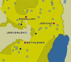
Points versus lines
In the project of fortification that ensued, one energised
by growing hostilities along the new ceasefire lines, two
geometric models of defence were explored: the principle of
linear fortification and a matrix of strong points spread
throughout the depth of a territory. Each of these alternative
principles was derived from military vocabulary and had been
employed in the fortification of the Sinai, where, during the
war of attrition of 1970-71, the edge was under constant
attack. But, as with many things Israeli, these military
models turned into the planning concepts that later guided the
nature and distribution of civilian settlement throughout the
West Bank.
|
 |
| Ariel Sharon and
David Ben Gurion on the Bar-Lev Line
|
Under the Labour administration of Golda Meir, two
Labourites Haim Bar-Lev and Yigal Allon were put in charge
of fortifying the edges of the occupied territories on two
different fronts. Bar-Lev, then IDF chief of staff, devised a
series of linear fortifications along the ceasefire line with
Egypt on the Suez Canal; Allon, then the minister of
agriculture, devised and implemented what later became known
as the Allon Plan.
This plan aimed to create and fortify a new borderline with
Jordan. It marked out the locations of a series of
agricultural outposts, to be settled by the Nahal Corps the
settling corps of the IDF along the western bank of the Jordan
rift valley thereafter termed the iron valley.
The Bar-Lev Line was the military counterpart of the Allon
Plan. Both were the products of a similar doctrine, one that
sought to establish a line of defence along the outer edges of
the territory. It so happened that in both cases the edge was
marked by a water line.
|
|
|
The Suez Canal
is the place where Israels territorial ambitions and
fears consolidated into physical form. The Israeli
public could no longer believe in the idea that its
borders are non-permeable from the outside. The trauma
of the canal campaign became deeply etched in the
national consciousness. |
|
|
|
|
The Bar-Lev Line was an immense technical undertaking that
demanded the shuffling of huge quantities of sand from across
the desert to the bank of the canal. There, it was piled up to
form a formidable artificial landscape composed of hardened
sand ramparts above ground, and a parallel system of deep
bunkers and communication trenches below it. Thirty-five
fortified positions (Maozim) were spread out along the
length of the canal at 10 kilometre intervals, overlooking the
Egyptian positions across the water line on African soil from
a mere 300 metres.
Ariel Sharon a popular and energetic general, a mythical
military figure since the 1950s when his audacious deep
cross-border retaliation operations earned him much fame with
Israeli youth served between 1969 and July 1973 as the chief
of southern command of the Israeli Defence Forces.
It was during this time that Sharon, always an overtly
political general, broke with traditional military ranks as
well as with his Labour-Zionist upbringing, and affiliated
himself with the political right. Sharon was also the only
general who dared challenge the logic of defence spelled out
by the Bar-Lev Line.
He argued again and again in series of heated meetings with
the General Staff that the army cannot win a defensive battle
on an outer line
, and proposed that the IDF should fight a
defensive battle the way it should be fought not on forward
line but in depth
. Sharon held that the Maozim
forced the IDF into static defence, offering sitting targets
to Egyptian artillery, and should thus be abandoned.
Instead he proposed, and partially implemented, a dynamic
system of point-based defence in depth composed of a series of
strong points (Taozim) spread out on elevated grounds
within the terrain on a series of mountain summits that
dominated the canal plain. Between the Taozim and the
canal he proposed to run mobile patrols, constantly and
unpredictably on the move.
Before long the entire zone was enveloped in a frenzy of
construction, mountain outposts were constructed and fortified
to become command and long-range surveillance points, and a
network of high-volume military roads was paved to connect
them. At the time it seemed that every available building
contractor in the country was making a good profit at the
canal-side.
But then, at the first opportunity, Sharon was dismissed by
Bar-Lev, and his plan remained uncompleted.
The principle of linear defence is to prohibit (or inhibit)
the enemy from gaining any foothold beyond it. General Erwin
Rommel, commander of the Wehrmacht defences along the
Atlantic in 1944, asserted the core of this principle when he
argued that the only chance to stop an Allied invasion force
was to beat them at the waters edge. But as the Germans knew
well after their experience with the supposedly impregnable
Todt Line, when the line is breached even at one location it
is much like a leaking glass of water rendered immediately
useless.
By contrast, defence based on a network of points in
depth relies on a matrix of interlocking strong points
connected by physical and electro-magnetic links: roads and
electronic communications. Each point can connect and
communicate with any other, and each point overlooks and
whenever necessary covers the other with firepower, thus
creating an interlocking fortified surface.
When the defensive matrix is attacked it can become
flexible and adapt to the fall of any number of points by
forming new connections across the matrix.
The geography of nodes in a matrix cannot be conventionally
measured in distance. Distance between nodes is not a
measurable absolute but a relative figure that is defined by
the speed and reliability of the connection that is, how
fast and how secure can one travel between given points.
The network defence is a spatial trap that allows the
defenders a high level of mobility while acting to paralyse
any possibility for enemy movement. Jeff Halper explains how effective this
strategy was in Vietnam where small forces of Viet Cong were
able to pin down some half-million American soldiers
possessing overwhelming firepower.
The Yom Kippur war
In 1973 the Bar-Lev line looked so steadfast that Moshe
Dayan, then minister of defence, claimed that it would take
the American and Soviet engineer corps together to break
through [it]. But on 6 October 1973, it took the Egyptian
military only a few hours to break through and overrun the
in-destructible line.
In the end, the line that had stood up to two years of
Egyptian artillery-fire throughout the war of attrition,
succumbed to water. British-made high-pressure water cannons
used the water of the Suez Canal to dissolve the hardened sand
and melt the formidable artificial landscape into pools of
mud.
The Egyptian military then set in motion ordnance systems
surprising in size and scope. Some 100,000 heavily armoured
troops were ferried onto the eastern, previously
Israeli-controlled bank, and made their way through the ravaged landscape a few
kilometres into the Sinai. Then, without encountering much
resistance, but scared of entering the fortified depth of
Israeli defences constructed only a few months earlier by
Ariel Sharon, stopped progressing and dug themselves in, guns
facing east.
Two days later, 8 October 1973, brought the most bitter
defeat in IDF history, when waves of bewildered Israeli
soldiers in an armoured counter-offensive broke against a
dug-in Egyptian army equipped with previously unknown personal
anti-tank missiles. That day, Moshe Dayan proclaimed that the Third
Temple was falling. A shift of national consciousness
occurred and a process began that forced Labour four years
later, for the first time in the history of the state, out of
government.
The war had broken out a few weeks before general elections
set for 31 October 1973. Sharon, a candidate of the right, and
Bar-Lev, by then a Labour party cabinet minister, both retired
generals, were drafted as reserve commanders. Each stepped one
step down the command ladder; Sharon receiving the armoured
143 Division (later known as the Likud Division) and Bar-Lev
the overall command of the southern front. Old rivalries
inevitably resurfaced as the glory-hungry generals used the
war as an electoral asset.
Ariel Sharon realised that whoever first counter-crossed
the canal to the Egyptian side would be crowned as the wars
hero. On his relentless drive towards the line, Sharon allowed
himself a large measure of autonomy, disregarding the orders
of Bar-Lev, at times shutting off communications altogether,
and at others pretending not to hear explicit orders screamed
over the radio.
After suffering many losses, he succeeded in breaking a gap
in Egyptian lines and established a bridgehead across the
canal to African soil over which the Israeli army flowed onto
the rear of the Egyptians, cutting off their supply lines and
encircling the entire 3rd Egyptian army.
The Israeli counter-crossing of the canal created a bizarre
stalemate. The two armies had switched sides across the water
line and across continents. Such was the power of linear
defence that it was crossed twice, in both directions, during
a war lasting less than three weeks.
The Yom Kippur war ended in unprecedented public outrage.
The heads of the general staff and of the Labour party rolled.
But Ariel Sharon, the general who devised the defence strategy
that deterred the Egyptians from progressing deeper into the
Sinai, and successfully led the Israeli counter-crossing of
the Suez Canal, was publicly perceived as the man who had
saved the nation.
Even thirty years later, the story is kept alive. This
summer, a few months ahead of the anniversary of the Yom
Kippur war, the IDF was pressured to release its official
historical account. It was completed a decade ago, but was
shelved, largely because Sharon feared that its publication
would undermine his popular image as the wars hero.
The Suez Canal is the place where Israels territorial
ambitions and fears consolidated into physical form. The
Israeli public could no longer believe in the idea that its
borders are non-permeable from the outside. The debate around
the construction and fall of the canals fortification and the
trauma of the canal campaign became deeply etched in the
national consciousness; and they were endlessly replayed and
refought in slow-motion mode, this time on the hills of the
West Bank.
Strategic points
The Likud came to power two elections later, in May 1977.
Ariel Sharon was appointed minister of agriculture, and took
over the ministerial committee in charge of settlement. This
was an influential and powerful portfolio in an administration
of politicians that had become accustomed to a permanent role
in the political opposition and were utterly inexperienced in
governance.
Sharon seized his opportunity to devise a new location
strategy for settlements in order to turn the West Bank into a
defensible frontier and consolidate Israeli control of the
occupied territories. Having successfully demonstrated the
shortcomings of the Bar-Lev Line, he now moved against the
second of the Labour defensive lines, the Allon Plan.
Seeking to implement the lessons of the Sinai campaign,
Sharon claimed that:
a thin line of settlements along the
Jordan would not provide a viable defence unless the high
terrain behind it was also fortified
. Consequently, he
proposed to establish other settlements on the high terrain
[and] several east-west roads along strategic axes, together
with the settlements necessary to guard them.
|
|
|
Sharon and Gush
Emunim saw in the depth of the West Bank a sacred
territory and a defensible frontier, a border without a
line, across whose depth a matrix of settlement could be
constructed. |
|
|
|
|
Labour had traditionally conducted its state-building
policies almost entirely through the construction of
settlements. Before the creation of the state, as Sharon
Rotbard has written, it used the Tower and Stockade
cooperative settlements to mark and defend Israels future
borders. After its creation, prime minister David Ben Gurion
laid out the so-called organic wall composed of a string of
development towns inhabited by immigrant communities, mainly
Jews from the Arab states, along the states new borders.
But after the 1967 war, Labour was indecisive about what
policy to take with regard to the new territories and was
unable to reinvigorate its past pioneering energies; thus it
pursued its settlement policies with far less enthusiasm and
vigour.
Instead it was Sharon, the Labourite turned Likudnik, and
Gush Emunim, the national religious and messianic
organisation, who managed to revitalise the pioneering ethos
of Zionism. They saw in the depth of the West Bank a sacred
territory and a defensible frontier, a border without a line,
across whose depth a matrix of settlement could be
constructed.
The artificially-created Green Line, Israels
internationally-recognised 1949 border, was deeply repressed,
and the borders became fluid and elastic again, pulled out to
incorporate every new settlement.
After the Yom Kippur war, linear fortifications were no
longer trusted and the sense was to fortify the entire depth
of the terrain. Thus the open frontier replaced the rigidity
of the line and blurred the distinctions between a political
inside and outside; or, in the words of the Israeli
sociologist Adriana Kemp, it blurred the difference between
the political space of the state and the cultural space of
the nation a difference hidden by the hyphenated concept of
nation-state.
Sharons plan
In a famous syllogism, Lenin once described strategy as
the choice of points where force is to be applied. Points
have neither dimension nor size; they are mere coordinates on
the X/Y-axis of the plane and on the Z-axis of latitude. In
Israel, the settlement location strategy is based upon a
close reading of the terrain and a decision made with the
precision of acupuncture regarding where effort should be
concentrated.
The fact that the word settlement means in Hebrew a point
on the ground, and sometimes simply a point (nekuda)
is indicative of a planning culture that considers the
positioning of a settlement less in terms of its essence, than
in terms of its strategic location.
Because settlements are autonomous and separate points on a
matrix, a reliable communication had to be established between
them.
In 1982, few months before his invasion of Lebanon, Sharon,
then minister of defence, published his Masterplan for
Jewish Settlements in the West Bank Through the Year 2010
later known as the Sharon Plan. In it he outlined the
location of more than a hundred settlement points, placed on
strategic summits, and marked the paths for a new network of
high-volume, interconnected traffic arteries reaching also
into the Israeli heartland.
|
|
|
The fact that
the word settlement means in Hebrew a point on the
ground is indicative of a planning culture that
considers the positioning of a settlement less in terms
of its essence, than in terms of its strategic location.
|
|
|
|
|
Ariel Sharon saw in the formation of continuous Jewish
habitation a way towards the annexation of the areas vital for
Israels security. These areas he marked onto the map attached
to his plan in the shape of the letter H. The H-Plan
contained two parallel north-south strips of land: one along
the Green Line containing the West Bank from the west, and
another along the Jordan valley, accepting the presence of the
Allon Plan to contain the territory from the east.
These two strips separated the Palestinian population
centres, organised along the central spine of the West Banks
mountain ridge from both Israel proper and from the (much
relieved) kingdom of Jordan. Between these north-south strips
Sharon marked a few east-west traffic arteries the main one
connecting through Jerusalem, thus closing a (very)
approximate H. The rest, some 40% of the West Bank, separate
enclaves around Palestinian cities and towns, were to revert
to some yet undefined form of Palestinian self-management.
The settlements, relying on their own weapons, ammunition
and military contingency plans, were to form a network of
civilian fortifications integrated into the IDFs overall
system of defence, serving strategic imperatives by
overlooking main traffic arteries and road junctions in their
region.
The role of settlements as observation and control-points
promoted a particular layout for their urbanity. The
(sub)urban layout of a mountain settlement is concentric; its
roads are stretched in rings following the topographical lines
closing a complete circuit around the summit.
The outward-facing arrangement of homes orients the view of
its inhabitants towards the surrounding landscape in which
national interests main roads, junctions and Palestinian
urban areas, compose a part of a picturesque panorama. The
essence of this geometric order, as Rafi Segal and Eyal Weizman have written, is
to produce panoptic fortresses optical devices on an
urban scale, laid out to generate observation, spatially and
temporally, all round.
The high ground, on which settlements were located, thus
offers the strategic assets of self-protection and a wider
view. But beyond being employed militarily, the urban layout
of vision also serves an aesthetic agenda: it allows for
contemplation over a pastoral landscape evocative of history,
one in which biblical scenarios could be easily imagined and
participated in, at least visually. All this feeds the
national mythic imagination, giving settlers the sense of
foundational authority based on long historical continuity.
|
 |
| Ariel Sharon and
Benjamin Netanyahu on the West Bank
|
In the early 1980s another of the construction frenzies
that are indicative of Ariel Sharons closeness to executive
power had began. The Biblical heartland of the West Bank
became overlaid by the two symbiotic and synergetic instruments
of security: the settlement observation point and the
serpentine road network, the latter being the prime device for
serving the former, the former overlooking and protecting the
latter.
Sharon realised the double potential of emerging
messianic-religious impulses: to settle a mythological
landscape and to facilitate the desire of the middle classes
to push outside of congested city centres to populate his
matrix of points with civilian communities. Unlike Labours
agricultural settlements of the Kibbutz and the Moshav, the new community settlements were
in effect dormitory suburbs of closely-knit social groups
composed mainly of national-religious-professional middle
classes.
|
|
|
Israeli suburbia
made perfect use of the system laid out for mobile
defence in depth merging the needs of a sprawling
suburbia with national security and political ambitions
to push ever more Israelis into the West Bank.
|
|
|
|
|
Architectural organisation and aesthetics were conscripted
in order to create uniform communities as well as to establish
the states control of its territories. Uniformity of
architectural taste was imposed through the repetition of a
small variety of single and double, family house-and-garden
structures. Beyond responding to middle-class suburban
aesthetics, the adorning of settlement homes with red roofs,
served a further military agenda identifying these sites
from afar as Israeli.
The fact that the inhabitants had to seek work outside the
settlements made them rely on the roads to connect them with
the employment centres in the metropolitan areas around Tel
Aviv and Jerusalem, within Israel proper. This was similar to
the way that the American suburbs developed as an offspring of
pacified second world war construction technology, and
especially around the system of interstate highways, developed
to serve the integrated industry of the American war economy.
Israeli suburbia made perfect use of the system laid out
for mobile defence in depth. The massive system of fifty
highways together with a modern matrix of infrastructure
became effective instruments of development merging the
needs of a sprawling suburbia with national security and
political ambitions to push ever more Israelis into the West Bank.
Sharon and the engineers, already experts in military
defence works, and now building for civilian communities, had
to become urban planners. Sharon
got tremendous
satisfaction seeing how everything was moving forward, how
drawings on a map were every day becoming more of a reality on
the ground.
|
 |
| Alfei Menashe -
an image from The Politics of Verticality
|
His planning decisions, however, were not made according to
professional criteria of economical sustainability, ecology or
efficiency of services, but were guided by a strategic agenda
focused on spatial manipulations. Planning under Sharon shed
any pretence to facilitate the social and economic improvement
of an abstract public and manifested itself fully as the
executive arm of the strategic and geopolitical agenda of the
Israeli state.
Architecture and planning were thus used as the continuation of war by other means . Just
like the tank, the gun and the bulldozer, building matter and
infrastructure were used to achieve tactical and strategic
aims. It was an urban warfare in which urbanity provided not
the theatre of war but its very weapons and ammunition. It was
a war in which a civilian population was drafted, knowingly or
not, to supervise vital national interests as plain-clothes
security personnel.
|
Who is Eyal Weizman?
Eyal Weizman is an architect based in Tel Aviv and
London. After graduating from the Architectural
Association in London, he worked with Zvi Hecker in
Berlin on several projects, and is now in private
practice. Amongst the projects done in partnership with
Rafi Segal, are the rebuilding of the Ashdod Museum of
Art (opened June 2003), a stage set for Itim Theatre
Company (premiered at the Lincoln Centre in
July 2003), and a runner-up proposal for the Tel Aviv
Museum competition.
The exhibition and the catalogue A
Civilian Occupation, The Politics of Israeli
Architecture which Eyal Weizman edited/curated
together with Rafi Segal were banned by the Israeli
Association of Architects, but were later shown at the
Storefront Gallery for Art and
Architecture (New York, February 2003 ), and in
Territories at the Kunst-Werke (Berlin, May 2003).
The catalogue is now published by Babel
Press and Verso.
Eyal taught architecture at the Bartlett School of
Architecture in London, at the University of Applied
Arts in Vienna and at the Technicon in Haifa. He has
conducted research and a map-making project for the
human rights organisation Btselem on violations of human rights
by architecture and planning in the West Bank .
He is developing The
Politics of Verticality, first published on
openDemocracy into a PhD thesis, a book and a
film. Eyals previous books are Yellow Rhythms (010 Publishers,
Rotterdam) and Random Walk (AASF London).
|